


July 31, 2024, 3:00 pm | Read time: 2 minutes
Just in time for the start of the Olympic Games in Paris, Google has released new features for Maps. One of them takes users on a journey into the past of la capitale.
To stay updated on the games, Google published a guide on how its apps and services can help. Almost casually, the company announced a “time travel” feature for Google Maps that uses augmented reality.
Old Paris in 3D
Google has now provided more information about the feature on its Keyword blog here. Like Immersive View in Google Maps, it is based on augmented reality. This means: search for a landmark, click “AR view,” and view it through your smartphone lens.
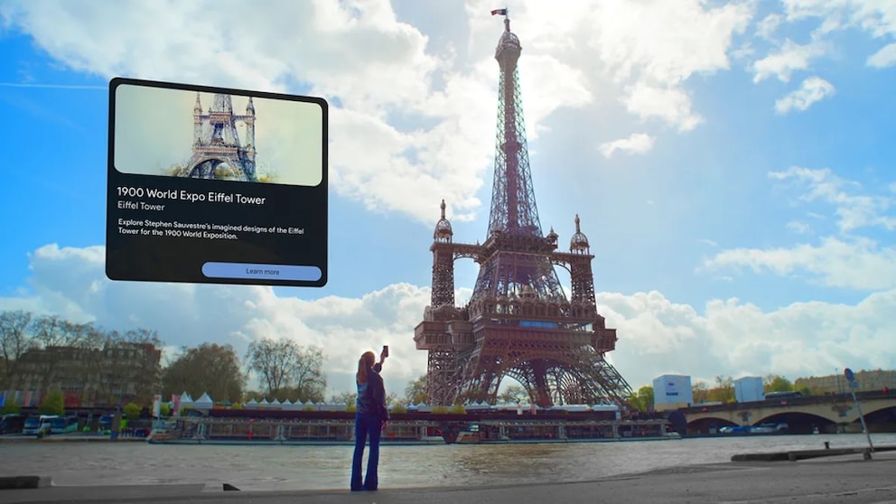
Google is taking it a step further by bringing old Paris back to life through imagery from its “Arts & Culture” initiative and a collaboration with gaming studio Ubisoft. Through Arts & Culture, Google works with cultural institutions and artists worldwide. The non-commercial initiative aims to preserve the world’s art and culture and make it accessible online.
The AR experience allows users to travel back to the 18th century. They can see Notre-Dame and its surroundings around 1789, explore the famous Bastille, and make the long-demolished Palais des Tuileries next to the Louvre reappear. All in 3D, of course.
Google Maps Shows Through Augmented Reality What Could Have Been
The temporary pavilions built for the 1900 World’s Fair in Paris along the Seine can also be admired with the augmented reality view in Google Maps. There are additional options available, sourced from Google Arts & Culture data, that never existed in reality. For instance, the app showcases various architectural concepts for the Eiffel Tower that were never realized.
The feature is now available in the Google Maps app. To try it out, you don’t need to be on-site. The augmented reality option appears even when searching for Parisian landmarks from elsewhere.